Precision mapping from
above the prairies — and beyond.
Survey-grade aerial data, LiDAR, orthomosaics, 3D terrain models, and GIS solutions for projects across Canada — guided by precision and grounded in respect for the Land and the communities connected to it.
A full stack of geospatial services.
From airborne surveys to construction progress and asset management programs — a full stack of specialized offerings, one accountable team.
Aerial Surveys
Survey-grade aerial data capture with centimeter-level precision across any terrain.
Drone Mapping
Advanced UAV platforms for fast, safe, and accurate geospatial collection.
Orthomosaic Mapping
True-ortho stitched imagery for planning, measurement, and documentation.
3D Terrain Modeling
High-fidelity digital surface and elevation models from dense point clouds.
LiDAR & 3D Scanning
Airborne and terrestrial LiDAR capture for infrastructure and asset documentation.
GIS Solutions
Spatial analysis and GIS workflows that turn raw data into decisions.
Construction Progress
Repeatable aerial captures to track progress, quality, and schedule.
Agriculture Mapping & Analysis
Aerial LiDAR and photogrammetry — terrain data for drainage, crop density mapping, and field-grade elevation models for precision agriculture across Canada.
Volumetric Analysis
Stockpile and earthwork volumes calculated from high-density point clouds.
Asset Management
Digital twins and spatial asset registries for long-term infrastructure tracking.
Inspections & Thermal Imaging
Safe aerial inspection and thermal imaging for infrastructure, rooftops, towers, and assets.
Fly Advanced.
Study on your own terms.
Our online Advanced RPAS Ground School is written to the Transport Canada knowledge requirements for Advanced Operations — everything you need to walk into the Small Advanced Exam prepared. Self-paced, lifetime access, designed and taught by working GIS pilots.
- 8 modules · ~30 study hours
- 50-question practice exams
- Certificate of Completion
- Lifetime access · no renewals
Five deliberate steps. Zero surprises.
Every engagement follows a repeatable, documented workflow — so you know exactly what to expect from first call to final delivery.
- STEP 01
Consultation
We scope project goals, deliverables, accuracy, and timelines with your team.
- STEP 02
Site Planning
Flight plans, GCPs, airspace authorizations, and safety protocols are prepared.
- STEP 03
Data Capture
Certified pilots operate professional UAV platforms to collect survey-grade data.
- STEP 04
Processing & Analysis
Imagery is processed into orthomosaics, DSMs, 3D models, and analytics layers.
- STEP 05
Final Deliverables
Clean, documented outputs delivered in the formats your workflow requires.
Built for the projects that can't wait.
We combine advanced UAV hardware with disciplined ground workflows and an obsession for clean deliverables. The result: data your engineers, planners, and decision-makers can actually trust.
Fast turnaround
Rapid deliverables from flight day to final package — kept on schedule without sacrificing accuracy.
Advanced drone tech
Modern UAV platforms with RTK/PPK and multi-sensor payloads.
Regulatory handled
We manage Transport Canada approvals, NAV drone, and site safety.
Local Manitoba HQ, national reach
Winnipeg-based crew, mobilizing across Canada for multi-site programs.
Accurate deliverables
Ground-controlled captures with documented QA on every project.
Enterprise-ready
Workflows built for construction, engineering, and municipal clients.
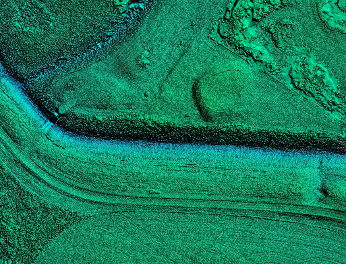
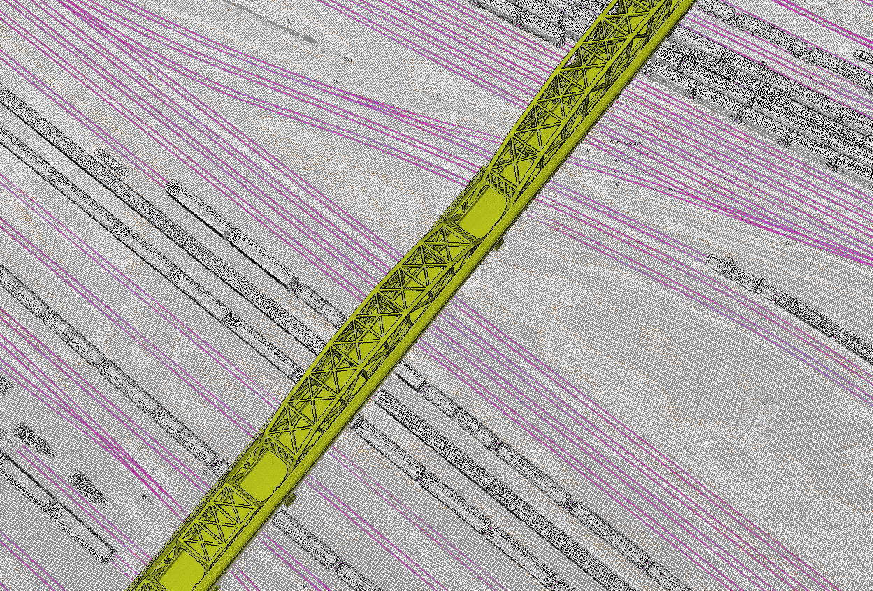
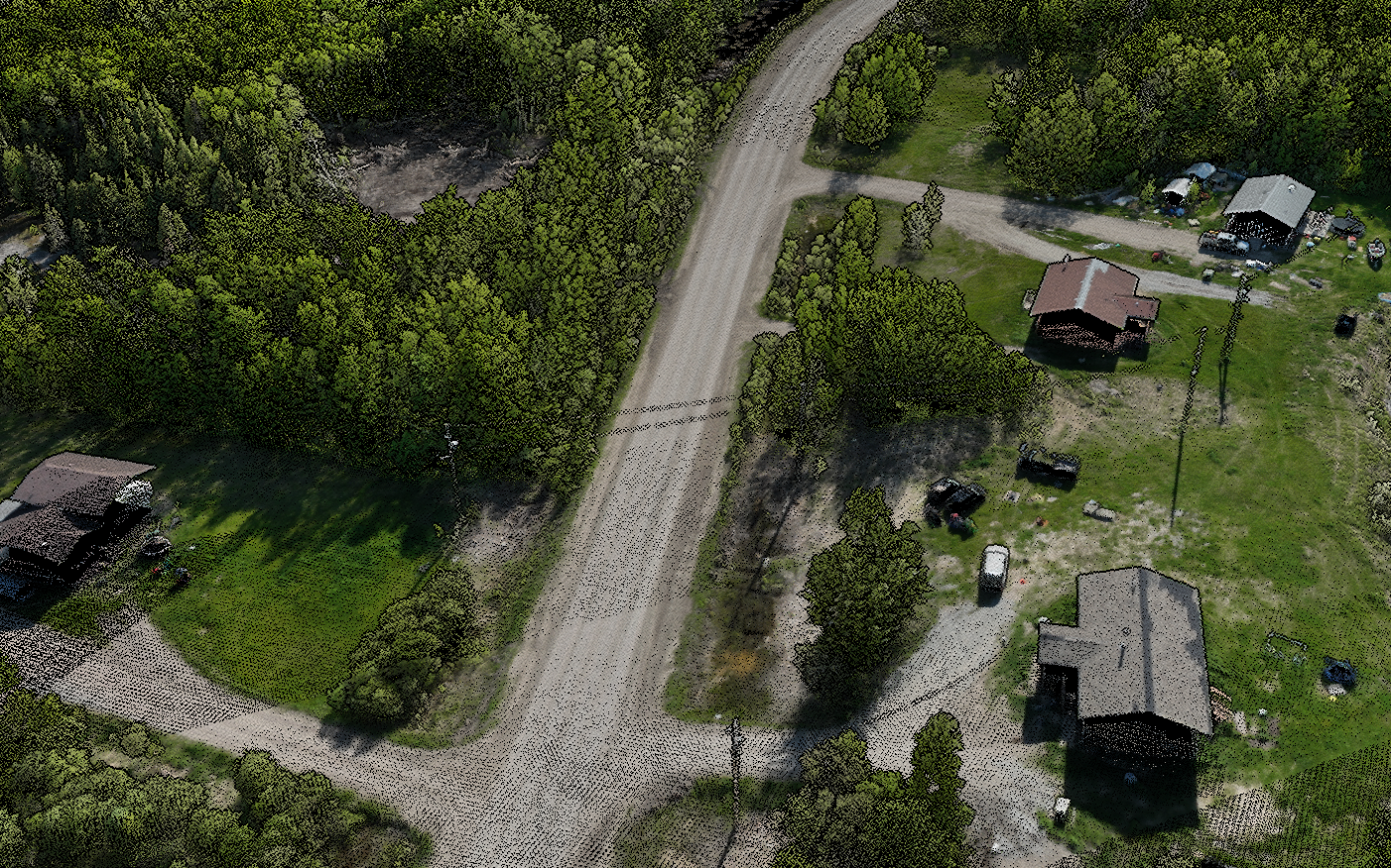
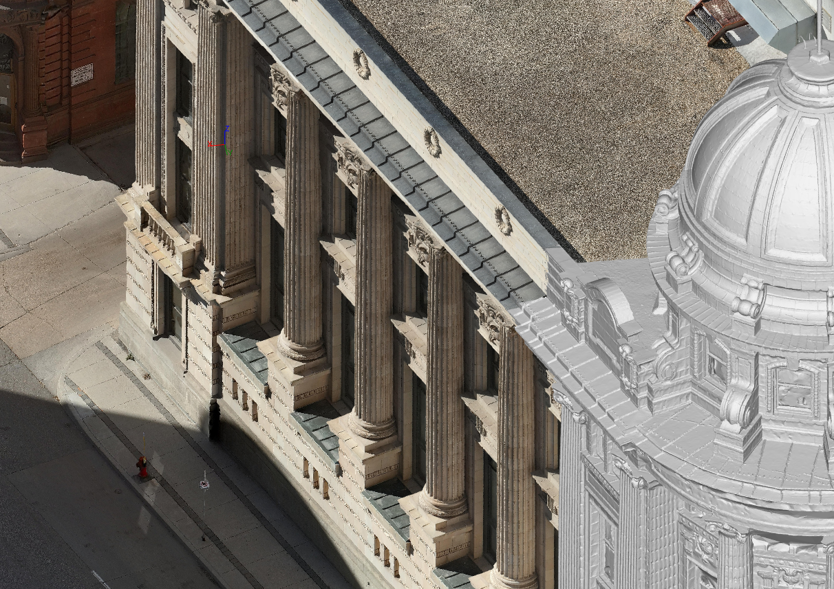
From air to actionable insight.
A look at the outputs we deliver — captured and processed by our team.

Real words. Real jobsites.
"Great service, quick turnaround time."
"Very professional and timely."
"The end result was really cool to see."
Tell us about the project.
Share a few details and we'll come back with a clear scope, timeline, and price — usually within one business day.