

Ground-truth data for
the farms that feed Canada.
Aerial LiDAR and photogrammetry purpose-built for agriculture - terrain data for drainage, crop density mapping, and field-grade elevation models delivered to your means.
Photogrammetry vs LiDAR.
Two acquisition methods we deploy depending on the deliverable you need — often used together on the same flight day.
Photogrammetry
Stitched aerial imagery and surface data captured from RGB cameras. Ideal for visual reference, whole-field documentation, and broad-coverage operations.
- Centimetre-grade orthomosaics from RGB aerial capture
- True-colour reference imagery for whole-field documentation
- Surface models and 3D meshes for visual context
- Fast turnaround and cost-effective for whole-field coverage
LiDAR
Active laser ranging delivers true ground elevation under crop canopy. The foundation for drainage, tile, contour, and volumetric work.
- True bare-earth elevation under crop canopy
- Drainage, contour, and tile design ready outputs
- Crop height & density modelling from canopy returns
- Survey-grade vertical accuracy, day or night, any lighting
Manitoba & Saskatchewan
Custom pricing based on acreage, terrain, and data requirements. Volume programs and multi-flight subscriptions are available for large-scale operations.
Minimum project fee applies to all services
- ▸Photogrammetry & LiDAR available
- ▸Contact us for a tailored quote
Available as add-ons.
Add-on capabilities priced per project — quoted alongside your photogrammetry or LiDAR engagement.
Multispectral imagery
NDVI, crop health analytics, and patch-level performance analysis from dedicated multispectral sensor capture — added to any photogrammetry or LiDAR mission.
Request pricing3D models of farming infrastructure
Photoreal scans and meshes of bins, sheds, fences, equipment, and on-farm structures for insurance records, asset tracking, and operational planning.
Request pricingDatasets only LiDAR can deliver.
Three concrete reasons LiDAR delivers more value than a photogrammetry-only flight.
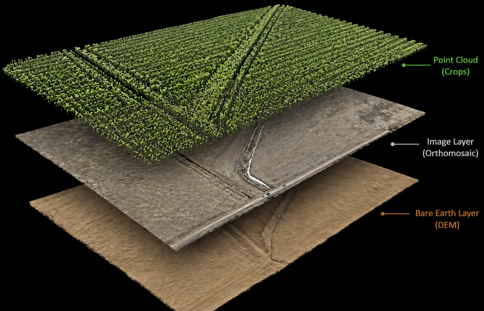
Bare-earth under canopy
Laser pulses penetrate crop canopy to expose true ground topography — the foundation for drainage, tile, and grading work that photogrammetry simply cannot deliver.
Drainage & contour ready
Cm-grade vertical accuracy makes LiDAR data drop straight into drainage software, surface-flow models, and earthworks design pipelines — no extra ground survey required.
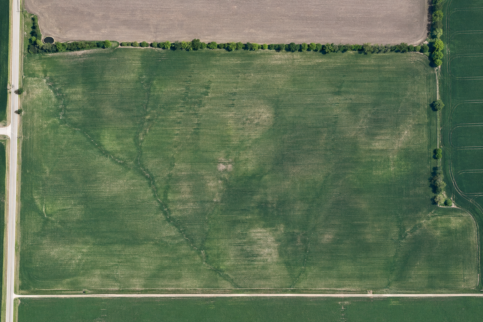
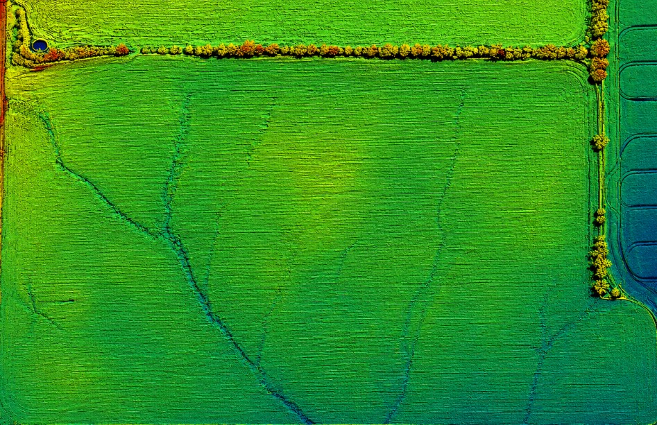
Crop height & density
Canopy returns separate top-of-crop from ground, letting agronomists quantify field-by-field biomass, height variance, and growth-stage performance directly from the point cloud.
From flight day to field decisions.
Deliverables in formats your agronomy, drainage engineering, or precision-ag platform already understands or user friendly outputs.
Drainage & tile planning
Bare-earth contours and slope rasters feed directly into surface drainage design and tile layout software.
Crop density & height
Canopy returns from LiDAR — or NDVI from multispectral capture — quantify field-by-field performance.
Field topography
Decimetre-accurate elevation models for grading, levelling, and pivot path planning.
Volumetric analysis
Pile and bin volumes, trench excavation, and earthwork tracking captured aerially in one pass.
Get pricing for your fields.
Tell us your acreage, deliverables, and timeline — we'll come back with a clear scope and a per-acre quote, usually within one business day.